Terrain Survey Assessment

Product Line
Survey and Planning
Use cases
Terrain Survey Assessment
Example
Flooding / Flood prone areas
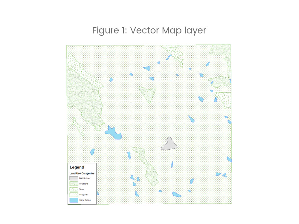
Land Use Map over Napa Valley.Five categories: Built Up Area, Scrubland (barren land, grass, scattered bushes or scattered trees), Trees (forest), Vineyards & Water bodies.
Category
Energy, Survey & PlanningExplanation
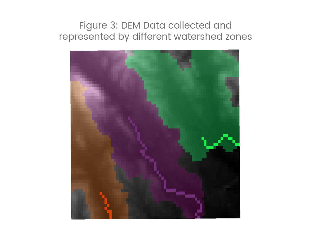
- Different watershed zones represented by different colours
- Any water that falls into a zone will stay within the zone and only flow out thru the outflow points (coloured lines)
- Water will not flow out thru any other point, and will not cross boundaries of watershed
- Light shades represent higher elevation and dark shades represent lower elevation
- Note how boundaries of watershed roughly correspond to higher elevations